
The Grand Canyon is huge, colorful, and full of stories.
This easy guide brings you 145 simple facts about how it formed, who lives there, and how to visit safely.
Whether you love rocks, animals, or big views, these bite-size facts will help you understand this natural wonder like never before.
Origins & definitions
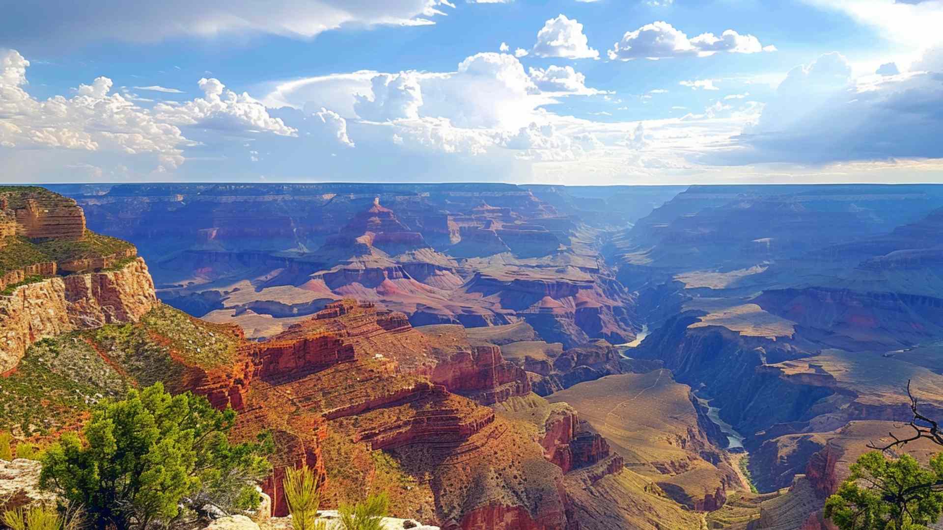
- The Grand Canyon is a massive gorge carved by the Colorado River in northern Arizona, USA.
- The canyon lies within the Colorado Plateau, a high, flat-topped region lifted up over millions of years.
- Grand Canyon National Park protects much of the canyon and the surrounding rims.
- The protected park area covers about 4,926 square kilometers (1,904 square miles).
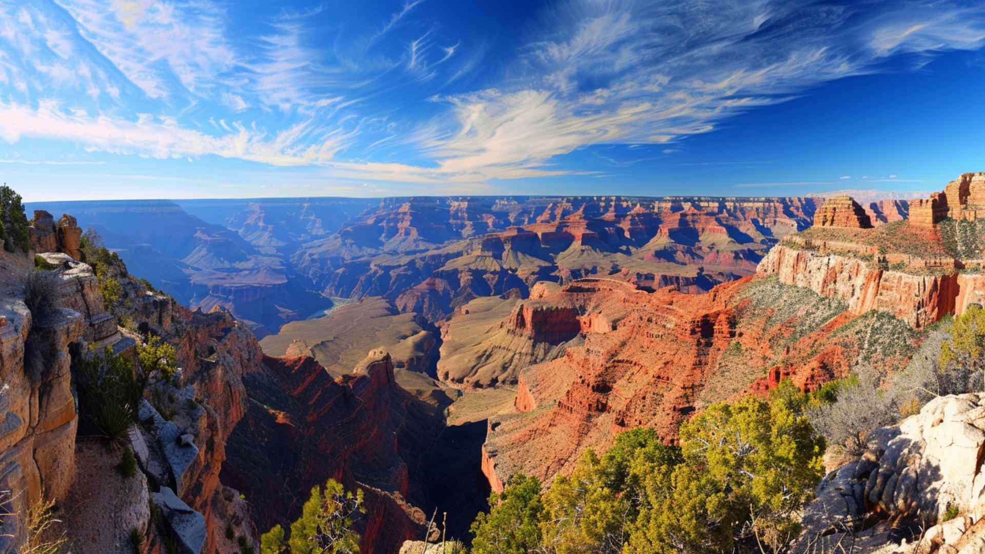
- The canyon stretches roughly 446 kilometers (277 miles) from Marble Canyon to the Grand Wash Cliffs.
- Its width ranges from less than 600 meters to more than 29 kilometers (18 miles) at the widest points.
- Its maximum depth exceeds 1,800 meters (6,000 feet) from rim to river in several areas.
- The South Rim is easier to reach by road and stays open year-round.
- The North Rim sits higher in elevation and closes to regular car traffic in winter due to snow.
- The Colorado River enters the canyon at Lees Ferry, which river runners mark as River Mile 0.
- The river exits the main canyon near the Grand Wash Cliffs before flowing toward Lake Mead.
- Marble Canyon forms the eastern segment and is counted within the Grand Canyon system.
- No road bridge crosses the Colorado River inside the park’s canyon corridor.
- Hundreds of side canyons feed water and sediment into the main gorge.
- The park was recognized as a UNESCO World Heritage Site in 1979.
Record-breakers & wow numbers
- The Grand Canyon often appears on popular lists of the Seven Natural Wonders of the World.
- The North Rim’s Point Imperial reaches about 2,680 meters (8,800 feet) above sea level.
- The South Rim averages around 2,100 meters (7,000 feet) above sea level near Grand Canyon Village.
- The river at the bottom flows near 750 meters (2,460 feet) above sea level around Phantom Ranch.
- The canyon’s rock walls display close to 2 billion years of Earth history.
- The Great Unconformity inside the canyon represents more than a billion years of missing rock record.
- The oldest rocks, called the Vishnu Basement Rocks, date to about 1.7–1.8 billion years ago.
- The Kaibab Limestone forms the hard caprock along much of the rim.
- The Coconino Sandstone preserves giant cross-beds from ancient wind-blown dunes.
- The Redwall Limestone creates tall, sheer cliffs stained red by iron-rich sediments.
- The park contains five of North America’s seven major life zones within its boundaries.
- Summer temperature differences of 15–20°C between rim and river are common.
- Lava Falls Rapid is among the most powerful rapids on the Colorado River in the canyon.
- The park manages a vast backcountry that is largely treated as wilderness under protective policies.
- More than a thousand caves are believed to exist in the canyon, with only a fraction explored.
- The Skywalk glass bridge on Hualapai lands extends about 21 meters (70 feet) from the rim.
- The Skywalk’s glass floor sits roughly 1,200 meters (4,000 feet) above the river.
- The longest maintained trail below the rim is the North Kaibab Trail.
- A typical rim-to-rim hike covers about 38–39 kilometers (24 miles) one way.
- The Colorado River through the canyon includes over 160 named rapids rated on a unique 1–10 scale.

Geology & formation
- The Grand Canyon formed as the Colorado River cut downward through uplifted rock layers.
- Uplift of the Colorado Plateau steepened the river’s slope and sped up erosion.
- Different rock strengths create the canyon’s “stair-step” cliffs and slopes by differential erosion.
- The Tonto Group includes Tapeats Sandstone, Bright Angel Shale, and Muav Limestone from the Cambrian Period.
- The Supai Group and Hermit Shale form many of the red ledges in the middle of the canyon.
- The Toroweap Formation and Kaibab Limestone make up the rim’s upper cliffs.
- The Grand Canyon Supergroup contains tilted Precambrian layers preserved in limited pockets.
- The Great Unconformity separates tilted Precambrian rocks from flat-lying younger strata.
- Ancient seas, rivers, and deserts laid down the stacked layers seen in the walls.
- Fossils of trilobites and other marine animals appear in several Paleozoic layers.
- The Coconino Sandstone records a vast Permian sand desert with giant dune cross-beds.
- Dark streaks called desert varnish coat cliff faces with iron and manganese oxides.
- The Uinkaret volcanic field sent basalt flows into the canyon during the late Cenozoic.
- Some lava flows dammed the river temporarily and formed short-lived lakes upstream.
- Vulcan’s Throne is a cinder cone volcano perched near Toroweap on the North Rim.
- Lava Falls Rapid formed where hard basalt narrows and steepens the river channel.
- Stream capture and headward erosion connected older canyon sections into today’s long gorge.
- Side canyons such as Havasu, Bright Angel, and Hermit Creek follow faults and weaker rock layers.
- Rockfalls and debris flows continue to reshape cliffs and rapids every year.
- Flash floods in slot-like tributaries can move boulders the size of small cars.
- The Little Colorado River brings blue-green water from mineral-rich springs to its confluence.
- Travertine terraces build up where carbonate-rich spring water deposits dissolved minerals.
- Hanging gardens grow in shady alcoves where groundwater seeps out of the rock.
- River terraces left high above today’s flow help scientists track past water levels.
- Erosion rates in the canyon change with climate, rock type, and river discharge through time.
Ecology & wildlife
- Life zones range from hot desert scrub by the river to cool spruce–fir forests on the high North Rim.
- Desert bighorn sheep nimbly climb steep, rocky slopes across the canyon.
- Mule deer are common in forests and meadows on the rims.
- The Kaibab squirrel, with tufted ears and a white tail, lives mainly on the North Rim.
- California condors soar over the canyon with wingspans approaching three meters (ten feet).
- Golden eagles and peregrine falcons hunt along cliffs and open skies.
- Rock squirrels are bold scavengers and cause many bite incidents when people feed them.
- Canyon tree frogs call noisily from seeps and streams during warm nights.
- Native fishes like the humpback chub still swim in the main river corridor.
- Rainbow and brown trout were introduced to cooler sections near the upper canyon.
- Ringtails, Arizona’s state mammal, are agile nighttime climbers near camps and buildings.
- Collared lizards can sprint on their hind legs to chase insects across sunlit rocks.
- Tarantula hawk wasps hunt tarantulas and are known for very painful stings.
- Prickly pear, agave, and yucca plants store water and thrive on arid slopes.
- Pinyon pine and juniper woodlands cover many mid-elevation benches.
- Ponderosa pine forests dominate the higher, cooler plateaus near the rims.
- Wildflowers burst into bloom after spring rains and during the summer monsoon.
- Elk sometimes wander near the South Rim, especially at dawn and dusk.
- Monsoon storms from July to September bring sudden downpours and frequent lightning.
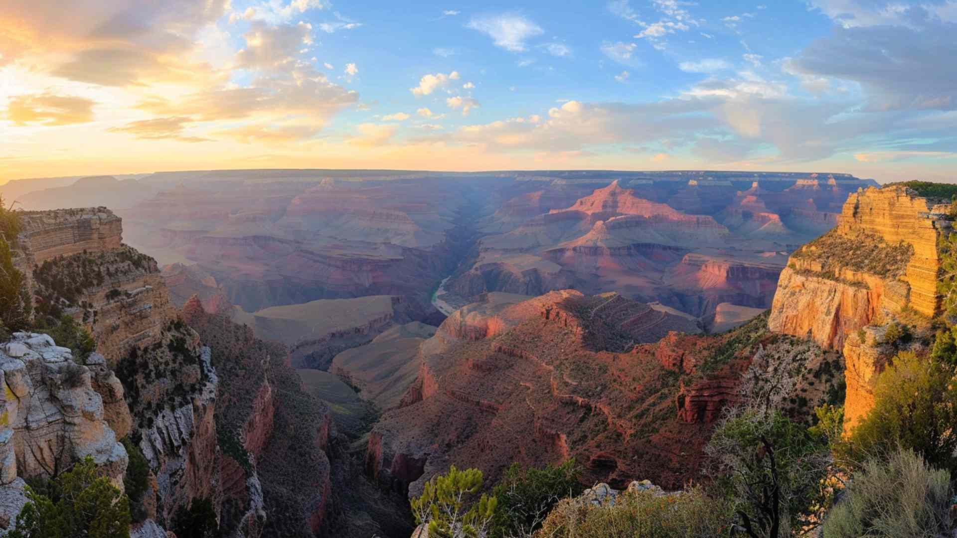
- Winter temperature inversions can fill the canyon with a dramatic sea of clouds.
Human history & culture
- People have lived in and around the Grand Canyon region for thousands of years.
- Ancient split-twig figurines made from twigs have been found in canyon caves.
- Ancestral Puebloan granaries and small dwellings are tucked into protected alcoves.
- Kaibab comes from a Southern Paiute term that can mean “mountain lying down.”
- Havasupai translates as “people of the blue-green water.”
- Hualapai means “people of the tall pines.”
- Hopi, Navajo, Zuni, Paiute, Hualapai, and Havasupai peoples maintain cultural ties to the canyon.
- Spanish explorers reached the area in the 1540s but could not descend to the river.
- Major John Wesley Powell led the first recorded boat expedition through the canyon in 1869.
- Powell lost boats and supplies in 1869 but finished the run with a reduced crew.
- Powell’s 1871–1872 expedition produced more complete maps and scientific notes.
- A national monument was proclaimed in 1908 to protect the canyon area.
- Grand Canyon National Park was established on February 26, 1919.
- El Tovar Hotel opened in 1905 and became a landmark on the South Rim.
- Architect Mary Colter designed Hopi House, Hermit’s Rest, and the Desert View Watchtower.
- Phantom Ranch opened in the 1920s and remains the only lodge at the canyon’s bottom.
- A trans-canyon pipeline carries drinking water from North Rim springs to the South Rim.
- Supai Village in Havasu Canyon still receives mail by mule on a regular route.
- In 2022 the rest area on Bright Angel Trail was renamed Havasupai Gardens to honor tribal history.
- Park rangers offer talks, cultural demonstrations, and popular night sky programs for visitors.
Visiting, trails & safety
- The South Rim provides year-round lodging, services, and a free shuttle bus system.
- The North Rim season is shorter and generally runs from late spring to autumn.
- The glass-floored Skywalk and nearby attractions sit on Hualapai lands outside the national park.
- The Bright Angel Trail descends a fault zone and features rest houses with seasonal water.
- The South Kaibab Trail follows a ridge with huge views but has no potable water on the way.
- The North Kaibab Trail passes Roaring Springs and follows Bright Angel Creek to the river.
- A rim-to-river-to-rim hike in summer can be dangerous because of extreme heat and dehydration.
- Park signs strongly advise against attempting rim to river and back in one day.
- Summer highs at the bottom can top 40°C (104°F), requiring careful hydration and pacing.
- Winter conditions on the rims can bring ice, snow, and below-freezing temperatures.
- Traction devices help hikers on icy upper trail sections during cold months.
- Guided mule trips operate from both rims on designated trails led by trained wranglers.
- River runners use oar rafts, paddle boats, and motorized craft depending on permit type.
- Private rafting permits are allocated by a lottery to balance access and resource protection.
- Commercial rafting trips range from single-day outings to multi-week full-canyon journeys.
- Crystal, Granite, Hermit, and Lava Falls are among the most famous rapids for boaters.
- Two pedestrian suspension bridges near Phantom Ranch allow hikers to cross the river.
- The Black Bridge was completed in 1928 for people, mules, and pack trains.
- The Silver Bridge carries the Bright Angel Trail across the river near the creek confluence.
- Carrying extra water, salty snacks, sun protection, and a map greatly improves trail safety.
Names & etymology
- Early American maps sometimes labeled the gorge as the Big Canyon before the modern name stuck.
- The term Grand Canyon became common in the late nineteenth century.
- South Rim viewpoints like Yavapai Point and Hopi Point honor Indigenous peoples of the region.
- Desert View Watchtower reflects ancestral Puebloan design in its round stone tower.
- Peak names like Zoroaster Temple and Vishnu Temple draw from world mythologies.
- The Kaibab Limestone is named for the Kaibab Plateau on the North Rim.
- Bright Angel names trace to a creek that offered a gentler route than nearby ravines.
- Toroweap comes from a Paiute term tied to the sheer western cliffs.
- Marble Canyon was named for polished limestone that early explorers mistook for marble.
- Havasu means blue-green water and describes the mineral-rich creek in Havasu Canyon.
For kids: quick comparisons
- The Grand Canyon is longer than the distance from New York City to Washington, D.C.
- Its deepest point is roughly as tall as six Eiffel Towers stacked end to end.
- The canyon is wide enough in places to fit more than 50 football fields side by side.
- A California condor’s wingspan is about as wide as a small car is long.
- In several places the river lies more than a mile (1.6 km) below the rim.
- Standing on the rim, you are over 2,000 meters above sea level, higher than many nearby towns.
- Hiking from rim to river and back is like climbing the stairs of a tall skyscraper several times.
- The steps in the canyon walls look like a giant staircase built by nature.
- The rock at the very bottom began forming long before dinosaurs ever walked the Earth.
- If you hiked one kilometer every day, it would take well over a year to cover the canyon’s length.
Pop culture & fun extras
- The Grand Canyon often appears in movies, cartoons, and classic family road-trip stories.
- Sunrise and sunset can shift the canyon’s colors from deep purple to bright gold in minutes.
- Winter fog sometimes fills the canyon like a white lake during full inversions.
- Stargazers visit for dark skies and Milky Way views during popular star party events.
- Ravens at busy overlooks have learned to unzip backpacks and open food boxes when people look away.
Quick FAQ
Why is the Grand Canyon so famous?
It is huge, colorful, easy to visit, and shows an extraordinary record of Earth’s history in its exposed rock layers.
How deep is the Grand Canyon?
It is over 1,800 meters (about 6,000 feet) deep in several places from rim to river.
How long is the Grand Canyon?
The canyon runs about 446 kilometers (277 miles) from Marble Canyon to the Grand Wash Cliffs.
Can you hike to the bottom and back in one day?
Most people should not, because heat, distance, and steep climbs make it risky, especially in summer.
When is the best time to visit?
Spring and autumn usually offer mild temperatures, clearer trails, and excellent views.
Ellie is the owner and sole author of Fun Facts, combining her mechanical engineering background with years of research-driven writing to deliver facts you can trust. Every article is thoroughly fact-checked and routinely updated as new science and sources emerge to keep information accurate and current. Her mission is to make learning delightful while upholding high standards of reliability and transparency.