
Honduras is a colorful Central American country with jungle-cloaked mountains, ancient Maya art, and coral reefs buzzing with fish.
This friendly guide packs quick facts you can trust, written for curious minds.
Ready to explore cities, wildlife, food, and festivals across the land of pine forests and warm Caribbean seas? Let’s go!
Origins & Definitions
- Honduras is a Central American country bordered by Guatemala, El Salvador, and Nicaragua.
- Its official name in Spanish is República de Honduras.
- The capital is Tegucigalpa, paired with Comayagüela in the same Central District.
- People from Honduras are called Hondurans, and the casual nickname is catrachos.
- The national currency is the lempira, abbreviated HNL.
- Spanish is the official language used in government and schools.
- The flag shows five blue stars symbolizing the historic union of Central American states.
- The international calling code is +504 and the internet top-level domain is .hn.
- Honduras follows Central Standard Time at UTC−6 all year with no daylight saving.
- The coat of arms features a triangle with volcanoes, tools, and a horn of plenty.
Geography & Nature
- Honduras covers about 112,492 km² of land, making it slightly larger than Iceland.
- The country has coasts on the Caribbean Sea in the north and the Pacific Ocean in the south.
- The Bay Islands—Roatán, Utila, and Guanaja—sit on the Mesoamerican Barrier Reef.
- The highest point is Cerro Las Minas in Celaque National Park at about 2,870 m.
- Lake Yojoa is the largest natural lake in Honduras.
- The Patuca River is among the longest rivers in Central America and flows to the Caribbean.
- The Ulúa River drains the fertile Sula Valley in the northwest.
- Mountain ranges cover most of the interior with pine and cloud forests.
- The Caribbean lowlands are hot and humid with banana and pineapple farms.
- The Pacific coast includes mangroves and volcanic cones like Isla El Tigre.
- Honduras has a tropical climate with distinct rainy and dry seasons.
- The interior rainy season typically runs from May to November.
- Waters around the Bay Islands stay warm year-round for snorkeling and diving.
- Honduras sits near major fault zones, so occasional earthquakes are possible.
- Atlantic hurricanes sometimes affect the north coast during late summer and autumn.
- Hurricane Mitch in 1998 caused extreme flooding and landslides across the country.
- Cloud forests in Celaque and Pico Bonito protect many rare plants and birds.
- The Río Plátano Biosphere Reserve safeguards vast tropical rainforest in La Mosquitia.
- The Mosquito Coast region is sparsely populated and rich in rivers and wetlands.
- The Trifinio area at the western border contains shared watersheds and highlands.
- Caratasca Lagoon in Gracias a Dios is one of the largest coastal lagoons in the country.
- The Aguán Valley is a major agricultural zone that can experience seasonal floods.
- The Comayagua Valley is a highland basin known for colonial history and farms.
- The Santa Bárbara Mountains hide caves, waterfalls, and coffee-growing slopes.
- The Western Highlands around Santa Rosa de Copán feature cool nights and tobacco farms.
- Shrimp farms line parts of the Gulf of Fonseca on the Pacific coast.
- Reefs around Roatán host hard corals, soft corals, sponges, and colorful reef fish.
- The Dry Corridor crosses southern and western Honduras with periodic droughts.
- Honduras manages dozens of protected areas, parks, and biological reserves.
- The country forms part of the Mesoamerican Biological Corridor linking wildlife habitats.

Record-Breakers & Wow Numbers
- Honduras is roughly the size of the U.S. state of Pennsylvania.
- Cerro Las Minas at ~2,870 m stands taller than the highest peaks in El Salvador and Nicaragua.
- Lake Yojoa spans around 79 km², making it the nation’s largest lake.
- Roatán stretches about 77 km long at its greatest length.
- The Mesoamerican Barrier Reef is the world’s second-largest barrier reef system.
- The Patuca River runs over 500 km from the mountains to the Caribbean Sea.
- The Río Plátano Reserve protects more than 5,000 km² of forest and wildlife.
- Copán’s Hieroglyphic Stairway forms the longest known Maya text built in stone.
- Scarlet macaws can live over 40 years in the wild under good conditions.
- Whale sharks visiting Utila can reach lengths of about 12 m.
- The Sula Valley hosts one of the country’s highest population densities.
- Puerto Cortés is among the largest deep-water ports on the Caribbean coast of Central America.
- Honduras is divided into 18 departments and 298 municipalities.
- The nation keeps one time zone year-round, simplifying travel schedules.
- Honduras has appeared in three FIFA Men’s World Cups: 1982, 2010, and 2014.

History & Heritage
- Indigenous peoples lived across present-day Honduras thousands of years before Europeans arrived.
- The Maya city of Copán thrived especially between the 5th and 9th centuries CE.
- Christopher Columbus reached the Bay Islands and northern coast in 1502.
- The name “Honduras” is often linked to the deep waters off parts of the coast.
- Early Spanish towns included Trujillo on the coast and Comayagua inland.
- Honduras declared independence from Spain on September 15, 1821.
- In 1823 the region joined the Federal Republic of Central America.
- Honduras became a fully separate republic after the federation dissolved in 1838.
- Comayagua was an early capital that later alternated with Tegucigalpa.
- Tegucigalpa became the permanent capital in 1880.
- The lempira is named for a Lenca leader who resisted Spanish conquest.
- Bananas rose as a major export in the late 19th and early 20th centuries.
- Railways along the north coast once carried bananas from fields to ports.
- Puerto Cortés developed into a key Caribbean shipping hub for the country.
- The Bay Islands were ceded by Britain to Honduras in 1860.
- Copán’s ruins were mapped in the 19th century and later carefully excavated.
- The 20th century included periods of civilian governments and military rule.
- Hurricane Fifi in 1974 caused heavy damage and loss of life.
- Civilian rule returned in the 1980s with new democratic institutions.
- Hurricane Mitch in 1998 reshaped infrastructure planning and disaster response.
- A bridge at Choluteca became famous after Mitch shifted the river’s course away from it.
- A national political crisis in 2009 led to a change in leadership.
- Major highway upgrades in the 2010s improved travel between key cities.
- A new international airport opened in Comayagua in 2021 to serve the capital region.
- Honduras elected its first female president in 2021, who took office in 2022.
People, Language & Culture
- Most Hondurans use Spanish in daily life, with regional accents across the country.
- Recognized groups include Lenca, Miskito, Pech, Tawahka, Tolupán, Ch’orti’, and Garifuna communities.
- Garifuna culture is famous for energetic Punta music and dance.
- Honduran Spanish uses voseo, where “vos” often replaces “tú” in casual speech.
- The national flower is the orchid Rhyncholaelia digbyana.
- The national mammal is the white-tailed deer.
- The national tree is the pine, celebrated in many reforestation events.
- Baleadas are thick flour tortillas folded with beans, cheese, and cream.
- Sopa de caracol is a coconut-rich conch soup from the north coast.
- Holiday tamales are commonly wrapped in banana leaves and steamed.
- Coffee from western highlands like Copán and Santa Bárbara is widely prized.
- Fried plantain slices called tajadas are a popular street snack.
- The friendly nickname catracho or catracha is used with pride at home and abroad.
- Towns celebrate patron saint festivals with parades, bands, and rides.
- The largest cities are Tegucigalpa in the highlands and San Pedro Sula in the north.
- La Ceiba hosts a lively carnival each May along the Caribbean coast.
- Modern styles like Punta Rock blend Garifuna rhythms with contemporary sounds.
- Lenca artisans produce distinctive pottery, textiles, and gourd crafts.
- Traditional wooden masks appear in dances such as Moros y Cristianos.
- Colonial churches in Gracias and Comayagua display ornate altars and towers.
- The lempira uses the symbol L in prices and accounting.
- Money sent home by migrants is an important part of many household budgets.
- Independence Day on September 15 brings parades, bands, and school displays.
- The school year commonly runs from February to November in many regions.
- Neighborhood soccer and futsal courts are popular gathering spots for families.

Wildlife & Conservation
- Honduras lies within the Mesoamerican biodiversity hotspot.
- Cloud forests harbor resplendent quetzals, trogons, and tiny hummingbirds.
- Lowland rainforests are home to jaguars, tapirs, and howler monkeys.
- The Río Plátano Biosphere Reserve is a UNESCO World Heritage Site.
- Coastal mangroves shelter fish nurseries and protect shorelines from storms.
- Sea turtles such as hawksbills and greens nest on Caribbean beaches.
- Iguanas bask on rocks and rooftops in warm coastal towns.
- Spectacled caimans and American crocodiles live in wetlands and lagoons.
- Isolated mountain ranges act as “sky islands” with unique amphibians.
- The Honduran emerald is the only bird species found nowhere else on Earth.
- Pine–oak forests cover large highlands and are adapted to occasional fires.
- Southern dry forests support thorny shrubs, cacti, and hardy mammals.
- Whale sharks aggregating off Utila support sustainable marine tourism.
- Overfishing and coral bleaching are ongoing challenges for reef health.
- Pico Bonito National Park offers trails from lowland rivers to cloud forests.
- Birdwatchers have recorded over 700 species across the country.
- Traditional ecological knowledge among Indigenous groups aids forest stewardship.
- Community programs near Copán help protect scarlet macaws from poaching.
- Deforestation pressures include cattle ranching and agricultural expansion.
- Reforestation efforts often target pine areas affected by bark beetle outbreaks.
Food, Sports & Daily Life
- Soccer is the most popular sport across Honduras.
- The top professional competition is the Liga Nacional de Fútbol Profesional de Honduras.
- The capital’s clásico rivalry features Olimpia versus Motagua.
- Youth leagues play weekend matches on fields in nearly every town.
- Baseball and basketball attract dedicated fans in certain regions.
- A classic breakfast includes eggs, refried beans, queso fresco, plantains, and tortillas.
- Fresh cheeses like cuajada and queso seco are common in markets.
- Coffee is typically brewed strong and sweet for morning or afternoon breaks.
- Fruit drinks often feature tamarind, pineapple, passion fruit, or hibiscus.
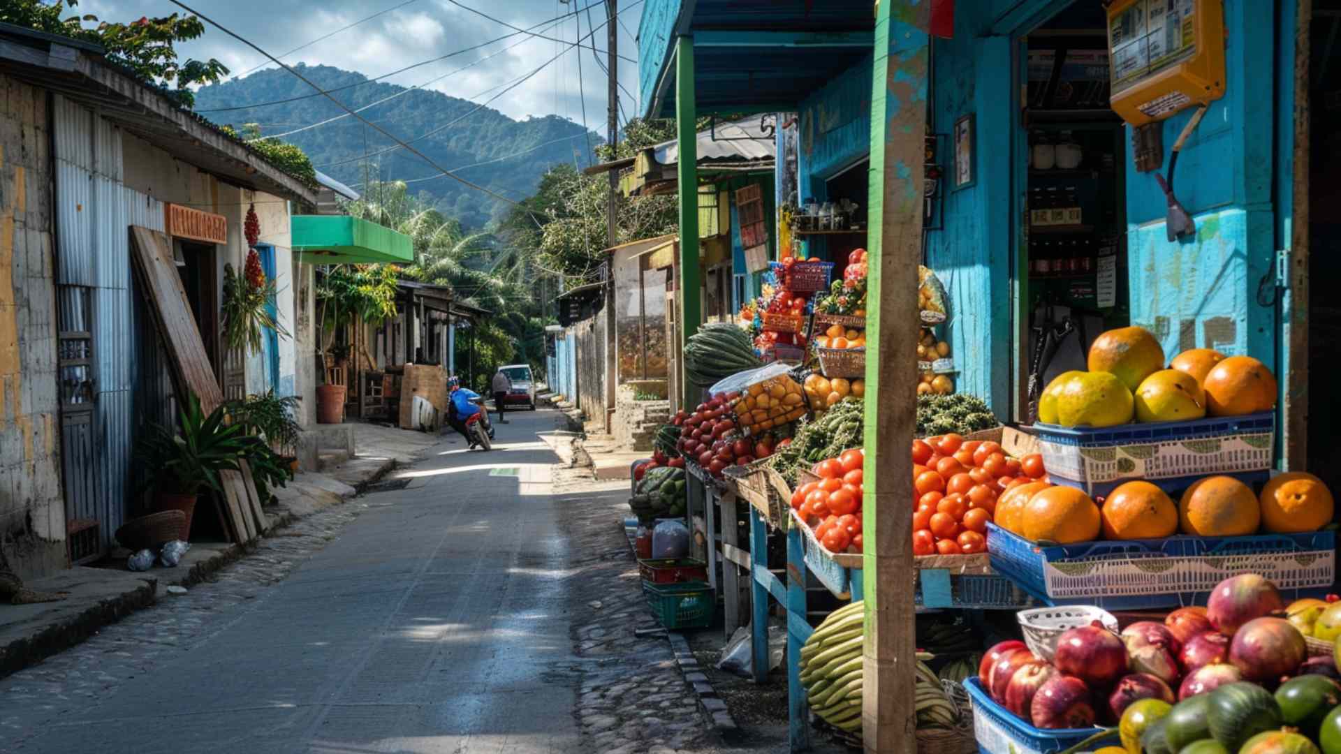
- Markets sell avocados, yuca, chiles, bananas, and pineapples year-round.
- Many households use both gas stoves and wood-fired fogones depending on location.
- Intercity buses connect Tegucigalpa, San Pedro Sula, and the north coast along the CA-5 corridor.
- Mototaxis and shared taxis provide short-hop transportation in many towns.
- Spanish-language radio and television carry news, sports, and telenovelas.
- Sundays often center on family meals, church events, and community visits.
Travel Highlights & Places
- Copán Ruinas offers a walkable town beside ornate Maya temples and sculptures.
- Roatán is famous for scuba diving, snorkeling, and relaxed Caribbean beaches.
- Lake Yojoa attracts birders and hosts small craft breweries on its shores.
- La Ceiba serves as a gateway to Pico Bonito National Park and the Bay Islands.
- Gracias preserves cobbled streets, nearby hot springs, and trails into Celaque National Park.
Quick FAQ
What is Honduras known for?
Honduras is known for the Maya site of Copán, the Bay Islands’ coral reefs, pine-clad mountains, and rich coffee culture.
What language do people speak in Honduras?
Spanish is the official language, with Indigenous languages and Garifuna spoken in some communities and English heard in parts of the Bay Islands.
What money does Honduras use?
The currency is the lempira, and prices are commonly marked with the symbol L.
When is the best time to visit?
Most travelers aim for the drier months from November to April, though weather varies by region.
Is Honduras in the same time zone year-round?
Yes, the country stays on UTC−6 all year without daylight saving.
Ellie is the owner and sole author of Fun Facts, combining her mechanical engineering background with years of research-driven writing to deliver facts you can trust. Every article is thoroughly fact-checked and routinely updated as new science and sources emerge to keep information accurate and current. Her mission is to make learning delightful while upholding high standards of reliability and transparency.