
Mount Everest is the highest point above sea level, but that simple record hides a mountain still rising, moving, freezing, eroding, and challenging the human body. Its summit sits on the Nepal-China border, its rocks began beneath an ancient ocean, and its official elevation was jointly updated in 2020. These 145 Everest facts explore geology, names, climbing, Sherpa history, oxygen, weather, routes, records, science, safety, and conservation.
Mount Everest basics
- Mount Everest is the highest mountain above mean sea level on Earth.
- Its officially agreed snow-surface elevation is 8,848.86 meters.
- That is about 29,031.7 feet.
- China and Nepal jointly announced the current official elevation in December 2020.
- The summit lies on the international boundary between Nepal and China.
- The Chinese side is in the Tibet Autonomous Region.
- The Nepalese side is in Sagarmatha National Park.
- Everest is part of the Himalaya mountain system.
- It belongs to the Mahalangur Himal subrange.
- Lhotse, the world’s fourth-highest mountain, stands immediately south of Everest.
- Nuptse is another dramatic neighboring peak.
- The South Col separates Everest from Lhotse.
- The summit is high enough to enter the lower stratosphere during some weather conditions.
- Air pressure at the summit is roughly one-third of sea-level pressure, varying with weather.
- The mountain is still changing as tectonic uplift, earthquakes, ice, weather, and erosion act on it.
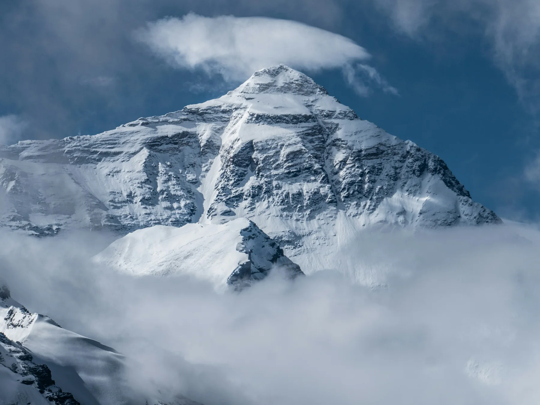
The mountain has several names
- The English name honors British surveyor George Everest.
- George Everest himself did not discover the mountain.
- He served as Surveyor General of India before the peak’s height was calculated.
- The Great Trigonometrical Survey initially identified the mountain as Peak XV.
- Surveyor Radhanath Sikdar is widely credited with calculations showing Peak XV was exceptionally high.
- The Royal Geographical Society adopted the name Mount Everest in 1865.
- George Everest reportedly preferred local geographic names when they were available.
- His surname was probably pronounced differently from the common modern English pronunciation of the mountain.
- In Tibetan, the mountain is commonly called Chomolungma or Qomolangma.
- The Tibetan name is often translated with meanings connected to a goddess or mother of the world.
- In Nepali, the mountain is called Sagarmatha.
- The Nepali name became officially established during the 20th century.
- Different naming traditions reflect different histories and cultures around the mountain.
- Maps may display Everest, Qomolangma, Chomolungma, or Sagarmatha depending on language and context.
- The mountain existed in local knowledge long before British surveyors assigned it an English name.
Everest began under an ancient ocean
- The Himalayas formed because the Indian tectonic plate collided with Eurasia.
- India once lay much farther south.
- The plate moved northward over tens of millions of years.
- The Tethys Ocean once separated India from Eurasia.
- Sediments accumulated on that ancient ocean floor.
- Continental collision compressed, folded, faulted, and uplifted those rocks.
- Some rocks near Everest’s summit are marine sedimentary rocks.
- They contain evidence of an environment that existed beneath an ancient sea.
- Limestone occurs high on the mountain.
- Metamorphic rocks occur lower in the massif.
- The Main Central Thrust and related structures helped build the Himalayan crust.
- The Indian plate continues moving northward today.
- That continuing collision produces earthquakes throughout the region.
- GPS measurements show the Himalayas are still deforming.
- The world’s highest summit is therefore a product of ocean sediment lifted by continental collision.
How surveyors measured Everest
- Early surveyors could not simply climb Everest with a tape measure.
- They measured angles to distant peaks from surveyed locations.
- Triangulation allowed height calculations from known distances and angles.
- Surveyors had to correct for Earth curvature.
- They also corrected for atmospheric refraction.
- Snow depth complicated the question of whether height meant rock or snow surface.
- A famous 19th-century calculation produced a height close to 29,000 feet.
- The published value became 29,002 feet after refinements.
- Later surveys used more sophisticated instruments.
- Modern teams use satellite navigation receivers.
- Ground-penetrating radar can help distinguish snow and rock surfaces.
- Gravity measurements improve elevation calculations.
- Nepal surveyed Everest after the 2015 earthquake.
- China conducted its own modern summit survey in 2020.
- The two countries agreed on 8,848.86 meters as the official snow height in December 2020.
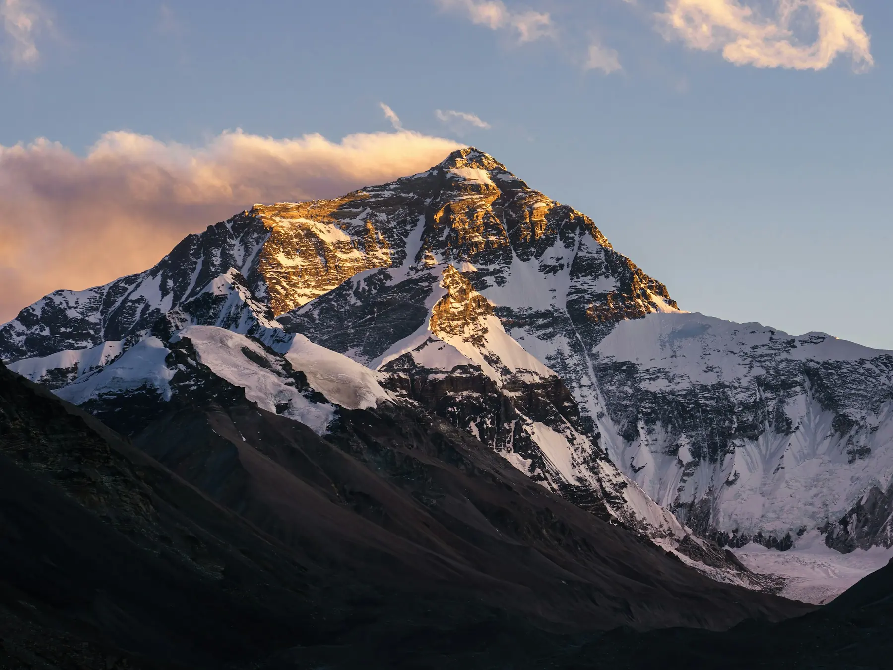
The first confirmed ascent
- British expeditions attempted Everest from Tibet during the 1920s.
- Nepal was largely closed to foreign mountaineers at that time.
- George Mallory participated in several early expeditions.
- Mallory and Andrew Irvine disappeared high on Everest in 1924.
- Whether either man reached the summit remains unknown.
- Mallory’s body was found in 1999.
- Irvine’s fate and the pair’s summit question remain subjects of historical investigation.
- Nepal opened more widely to mountaineering after World War II.
- The 1953 British expedition approached from Nepal.
- Edmund Hillary was a New Zealand beekeeper and mountaineer.
- Tenzing Norgay was an extraordinarily experienced Sherpa climber.
- Hillary and Tenzing reached the summit on May 29, 1953.
- Their ascent is the first confirmed successful climb of Everest.
- They spent only a short time on the summit before descending.
- News of the ascent reached Britain near the time of Queen Elizabeth II’s coronation.
Sherpa is both an ethnic identity and a climbing word
- The Sherpa are an ethnic group native to high Himalayan regions.
- Many Sherpa communities live in Nepal’s Khumbu region near Everest.
- The word Sherpa should not be used as a generic synonym for porter.
- Sherpa climbers became essential to Himalayan expedition history.
- They carried loads, fixed routes, established camps, guided clients, and made major climbing decisions.
- Tenzing Norgay was one of the most famous Sherpa mountaineers.
- Modern high-altitude workers often make repeated trips through dangerous terrain before clients arrive.
- The Khumbu Icefall is a particularly hazardous workplace on the southern route.
- Sherpa families have experienced disproportionate losses in climbing disasters.
- High-altitude work can provide substantial income relative to many local jobs.
- It also carries serious risk.
- Sherpa culture includes Tibetan Buddhist traditions.
- Many expeditions participate in a puja ceremony before climbing.
- The ceremony asks for blessing and safe passage on the mountain.
- Everest history makes little sense if Sherpa climbers are treated as anonymous support rather than central mountaineers.
The death zone
- Mountaineers commonly call elevations above about 8,000 meters the death zone.
- At those heights, oxygen availability is too low for long-term human survival.
- The body cannot fully acclimatize to the summit environment.
- Climbers become weaker even while resting.
- Decision-making can deteriorate.
- Coordination can decline.
- Appetite often disappears.
- Sleep becomes difficult.
- High-altitude cerebral edema can cause dangerous brain swelling.
- High-altitude pulmonary edema can fill the lungs with fluid.
- Both conditions can be fatal.
- Immediate descent is a critical treatment when severe altitude illness develops.
- Supplemental oxygen increases the oxygen available to a climber but does not make the summit equivalent to sea level.
- Oxygen systems can fail, freeze, leak, or run empty.
- Time management above 8,000 meters is one of the most important safety decisions on Everest.
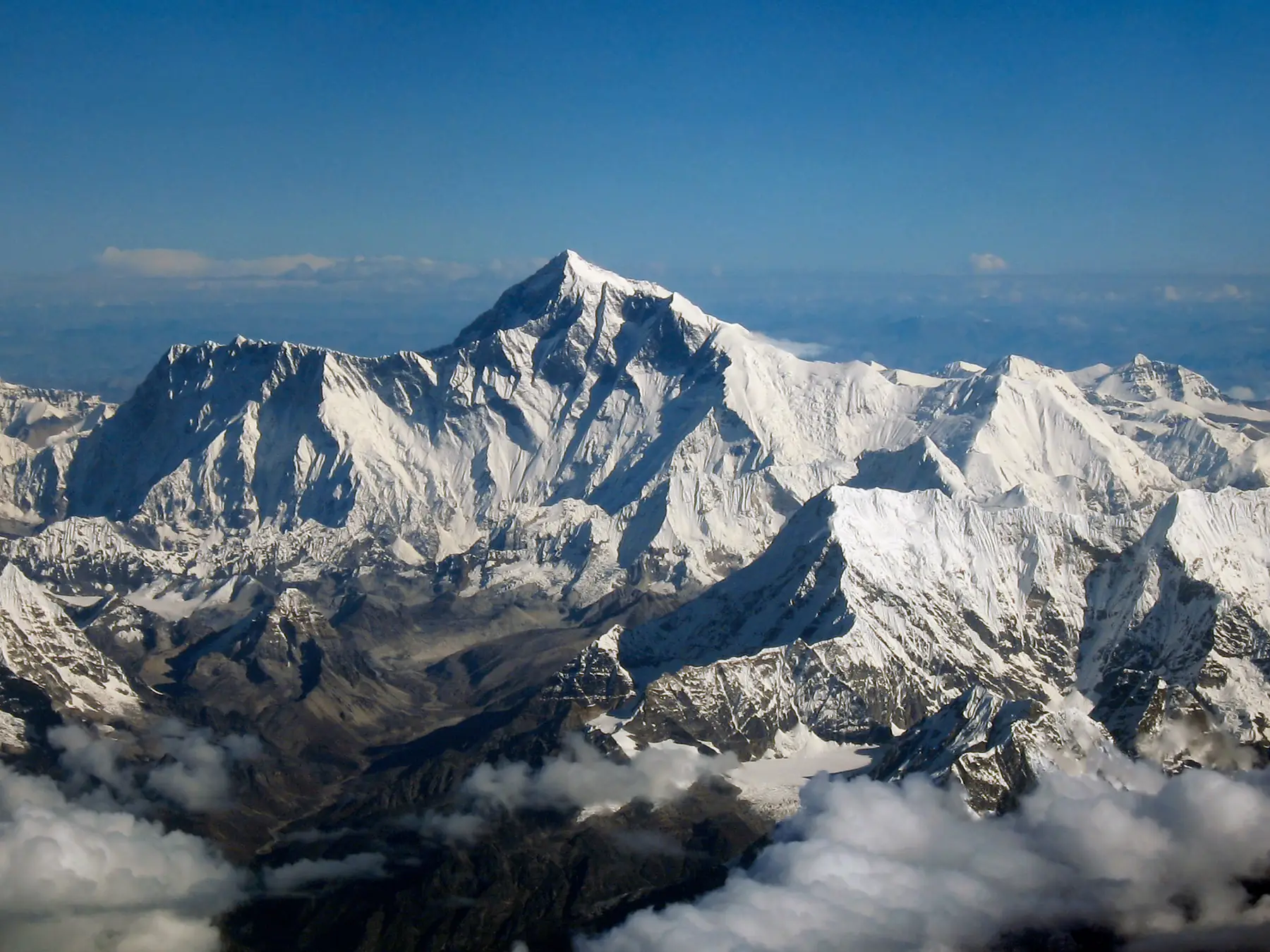
Two main climbing routes
- The two most commonly used Everest routes approach from Nepal and Tibet.
- The standard southern route begins in Nepal.
- It passes through the Khumbu Icefall.
- Climbers then cross the Western Cwm.
- The route ascends the Lhotse Face.
- Camp IV is commonly established near the South Col.
- Summit climbers then ascend the southeast ridge.
- The northern route approaches through Tibet.
- It uses the North Col and north ridge system.
- Both sides expose climbers to extreme altitude and weather.
- Ladders, fixed ropes, and anchors are used in technical sections.
- Routes through the Khumbu Icefall must be adjusted because the glacier moves.
- Crevasses can open and close.
- Seracs, huge blocks or towers of ice, can collapse without warning.
- No route to Everest’s summit is safe simply because thousands of people have used it before.
Weather controls summit attempts
- Everest’s summit is exposed to the upper atmosphere’s powerful winds.
- The jet stream can pass directly over the mountain.
- Winter summit winds can be ferocious.
- Most commercial summit attempts occur in a narrow spring season before the summer monsoon.
- Climbers wait for short forecast periods with lighter winds.
- These periods are called weather windows.
- A favorable forecast can send many teams toward the summit at once.
- That creates crowding on fixed routes.
- Queues can increase time spent at extreme altitude.
- Cold injury risk rises when climbers stop moving.
- Weather can change faster than a climber can descend.
- Cloud and snow can erase tracks.
- Strong winds can destroy tents.
- Wind chill makes exposed skin freeze much faster.
- Modern satellite forecasts improve planning but cannot remove mountain weather uncertainty.
Ten surprising Mount Everest facts
- Everest’s official height changed to 8,848.86 meters after a joint China-Nepal announcement in 2020.
- Marine limestone occurs near the summit because those rocks began beneath an ancient ocean.
- George Everest did not discover the mountain that carries his surname.
- The famous 1924 Mallory-Irvine summit mystery remains unresolved.
- Edmund Hillary and Tenzing Norgay share credit for the first confirmed ascent.
- Sherpa is an ethnic identity, not a generic word for any mountain porter.
- The human body cannot fully acclimatize to the summit’s death-zone environment.
- The Khumbu Icefall moves continuously because it is part of a flowing glacier.
- The summit can be struck by jet-stream winds.
- For more extreme geography, explore our Himalayas facts when available and Science facts.
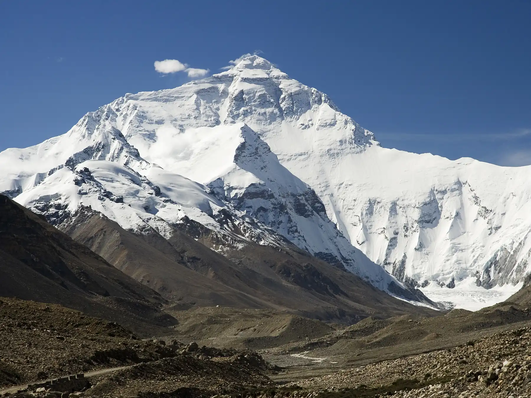
Quick Mount Everest FAQ
How tall is Mount Everest?
The official snow-surface elevation jointly announced by Nepal and China in 2020 is 8,848.86 meters, or about 29,031.7 feet.
Who first climbed Everest?
Edmund Hillary of New Zealand and Tenzing Norgay, a Sherpa mountaineer, made the first confirmed ascent on May 29, 1953.
Which country owns Mount Everest?
The international boundary between Nepal and China runs across the summit, so the mountain is shared by both countries.
Why is Everest still growing?
The Indian tectonic plate continues colliding with Eurasia, deforming and uplifting the Himalayas even as erosion wears them down.
What is the death zone?
The region above about 8,000 meters where oxygen pressure is too low for the human body to acclimatize indefinitely and physical deterioration continues.

Ellie is the owner and sole author of Fun Facts, combining her mechanical engineering background with years of research-driven writing to deliver facts you can trust. Every article is thoroughly fact-checked and routinely updated as new science and sources emerge to keep information accurate and current. Her mission is to make learning delightful while upholding high standards of reliability and transparency.